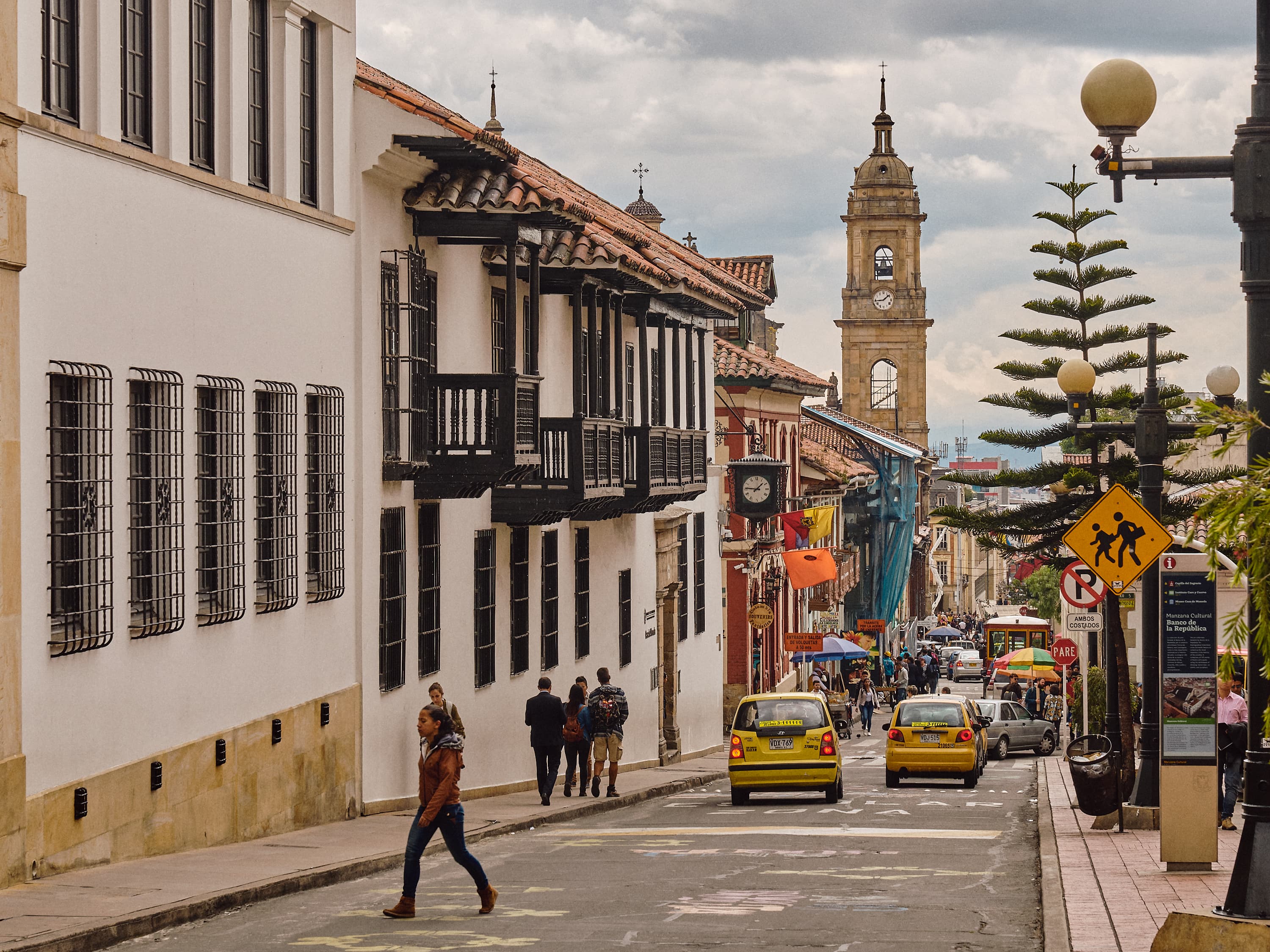
Bogotá
Decide whether to visit or live in Bogotá, then explore current conditions, local people, the map, and concise sourced context.
Check visit & living safetyUpdated Monday, September 14, 2026 · sourced live layer and versioned editorial content
AI-assisted, evidence-constrained research · how this page is made
Would you visit or live in Bogotá?
Choose your plan and circumstances. The result changes immediately using today's advisory, weather, air-quality, and sourced local signals.
Climate normals · 2016–2025
When to go: Bogotá month by month
Judged purely on 2016–2025 weather records, the friendliest months in Bogotá are typically January, August and September, with average daytime highs around 19–20°C. February is usually the warmest month (average high 20°C), January the coldest (average low 9°C), and November the wettest (about 128 mm). These are long-run averages, not a forecast.
| Month | Avg high (°C) | Avg low (°C) | Rain (mm) | Sunshine (h/day) |
|---|---|---|---|---|
| January | 19.4 | 8.8 | 58 | 11.1 |
| February | 19.7 | 9.8 | 83 | 10.5 |
| March | 19.0 | 10.1 | 127 | 10.1 |
| April | 18.8 | 9.9 | 123 | 9.8 |
| May | 18.4 | 10.0 | 90 | 9.8 |
| June | 17.9 | 9.5 | 61 | 10.6 |
| July | 17.6 | 9.1 | 45 | 10.7 |
| August | 18.7 | 8.9 | 27 | 11.2 |
| September | 19.5 | 8.9 | 30 | 11.2 |
| October | 19.2 | 9.1 | 79 | 10.3 |
| November | 19.0 | 9.3 | 128 | 10.1 |
| December | 19.3 | 9.1 | 64 | 10.9 |
Would you visit or live in Bogotá?
Contribute your perspective to the aggregated global community ledger.
Interactive geography
See Bogotá in context
Keep the deeper context
Stable history, culture, districts, and practical reference remain in the main reading flow while the live layers above continue changing.
01 · OverviewBogotá, in brief
Bogotá operates as the capital and largest city of Colombia, functioning as a territorial entity of the first order within the Capital District. Positioned at an average altitude of 2,640 meters above sea level across the high plateau of the Bogotá savanna in the Eastern Cordillera of the Andes, this highland settlement anchors the northern region of South America.
Before European arrival, the area supported active regional trade networks established by the indigenous Muisca people, who called the original site Thybzaca. These communities exchanged tropical fruits, coca, cotton, and gold at frequent markets while Muisca women managed essential salt production from brines. Cultural interaction shifted dramatically when Spanish conquistador Gonzalo Jiménez de Quesada led an expedition from Santa Marta, reaching the Andean plateau and establishing a military camp on 6 August 1538 at the modern-day Chorro de Quevedo square with the initial name Nuestra Señora de la Esperanza.
The settlement subsequently transitioned into Santafé, serving as the seat of the Spanish Royal Audiencia of the New Kingdom of Granada from 1550 and later becoming the capital of the Viceroyalty of New Granada. Following the Battle of Boyacá on 7 August 1819, Simón Bolívar rebaptized the urban center as Bogotá to honor the Muisca people during the independence of Gran Colombia.
Presently, Bogotá stands as the primary political, economic, administrative, industrial, cultural, aeronautical, technological, scientific, medical, and educational hub of Colombia. The city houses the central offices of the executive, legislative, and judicial branches of government, alongside the nation's highest nominal GDP and the main financial market in the Andean natural region. El Dorado International Airport manages massive passenger and cargo volumes, while numerous universities, research centers, and libraries—such as the Virgilio Barco, Tintal, Tunal, and the National Library—sustain a rich cultural landscape across twenty administrative localities.
Frequently Asked Questions about Bogotá
Essential geographic, demographic, currency, and travel context verified from primary records.
01 · Q&AWhere is Bogotá located and what are its coordinates?
Bogotá is situated in Colombia at geographic coordinates 4.6097, -74.0817 with an elevation of an elevation monitored in local geographic surveys.
02 · Q&AWhat is the population and time zone of Bogotá?
Bogotá has a recorded population of approximately 7,674,366 and observes the America/Bogota time zone (COP).
03 · Q&AWhat languages and currency are used in Bogotá?
Official and commonly spoken languages in Bogotá include es-CO, and the circulating currency is COP.
04 · Q&AHow can I check live conditions and daily updates for Bogotá?
Today's Atlas provides continuous tracking for Bogotá, featuring real-time weather conditions, daylight cycles, local geographic signals, and verified daily briefs.